UGO point2point
July 24, 2007 (15:46 CET)
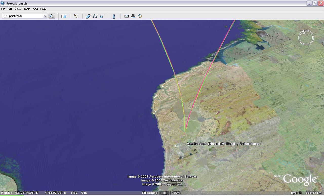
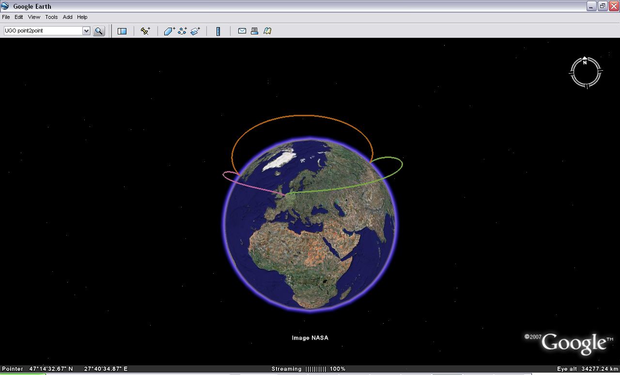
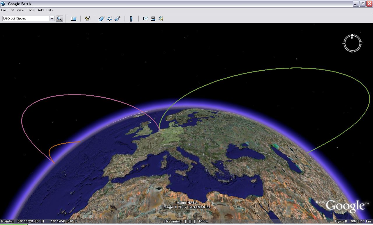
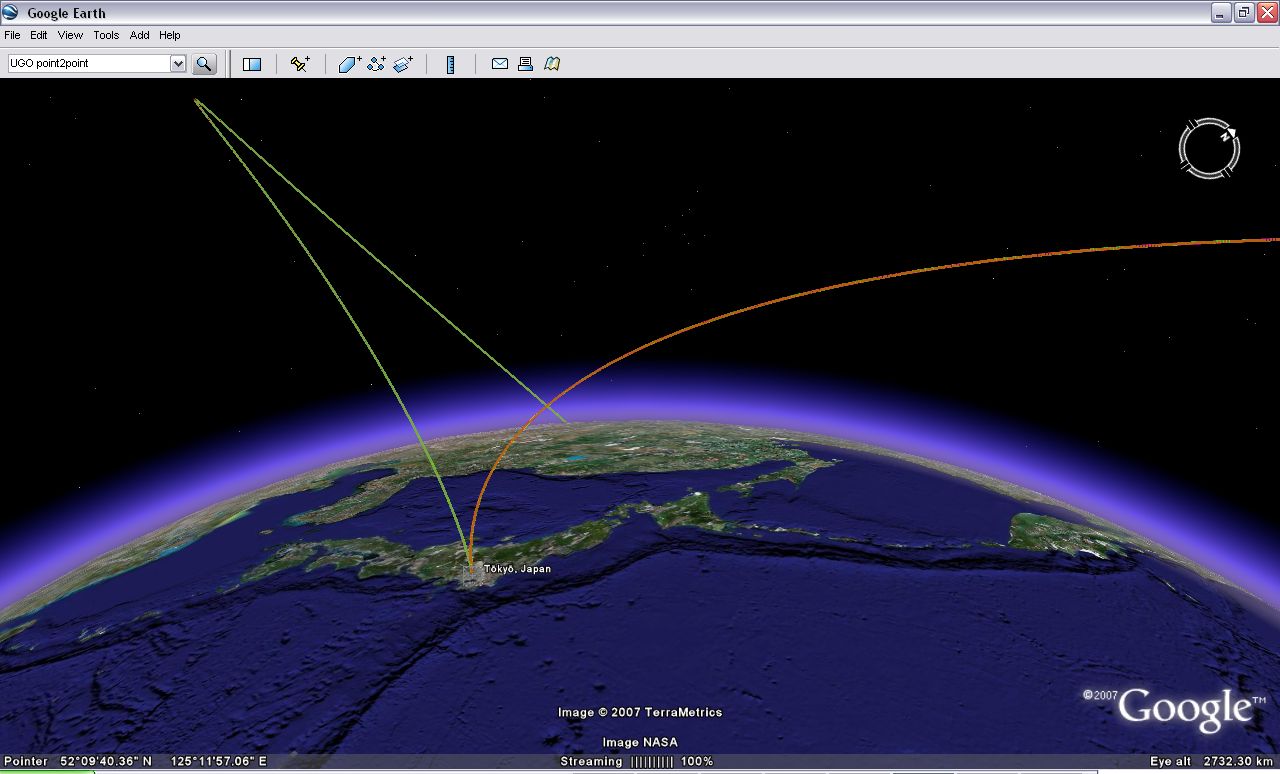
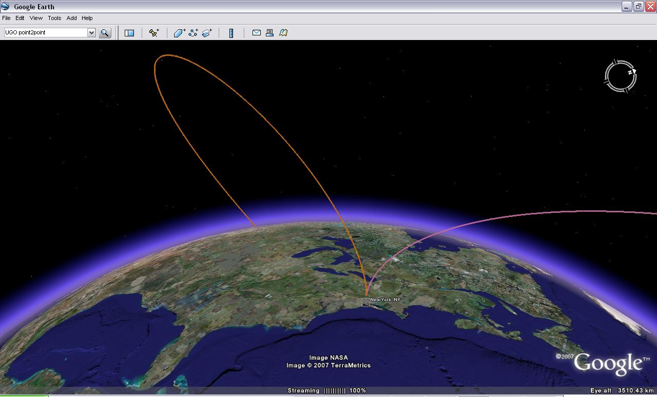
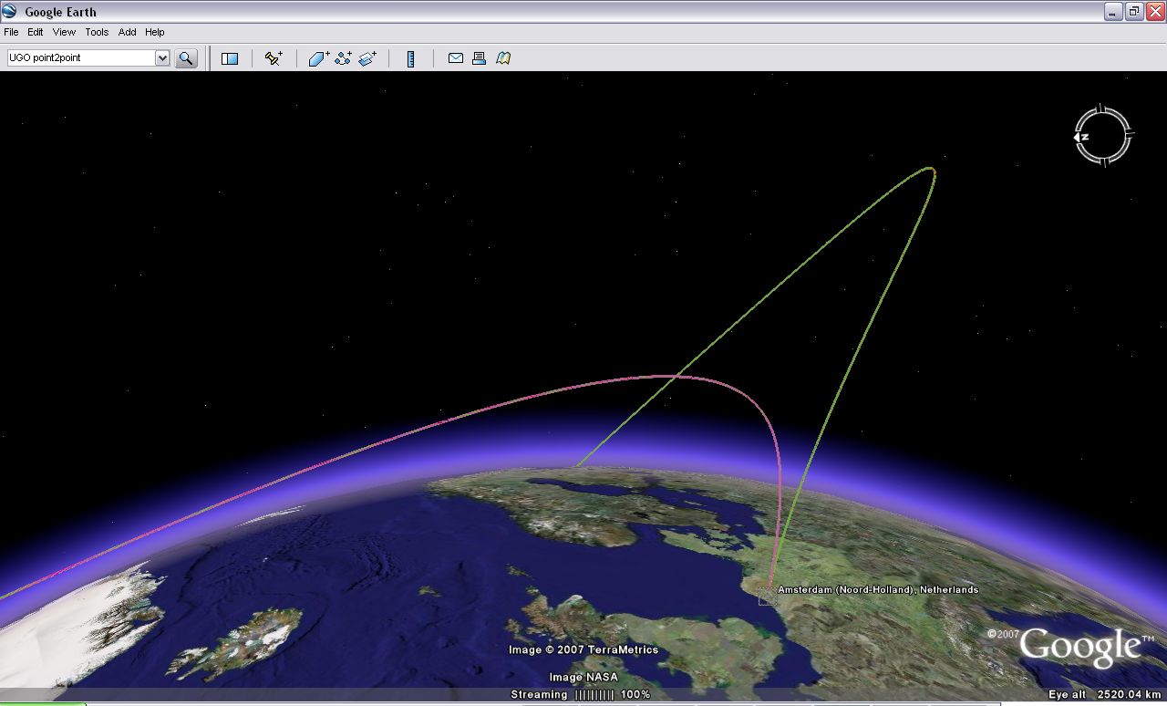
The original UGO idea of visualising people's virtual travels in Google Earth (earlier post) is still intruiging me. Its for example quite instructive to see a visualisation of a GE-provided flightpath (Google Earth Orbit?) when flying from say Amsterdam to Tokyo. See this .kmz file for a visualisation of a tour around the world using such virtual point2point travel.
Point2point travel in the real world is considered one of the holy grails of suborbital spaceflight, so it seems only natural that we get used to this type of travel through a virtual interface like Google Earth before we eventually hop on a suborbital Virgin Galactic 1-hour flight from Amsterdam to Tokyo. The actual flightpath of the Virgin Galactic craft of course does not have to resemble the GE-provided flightpath cause the latter is not bound by physics. Would be interesting to do a comparison to see what the GE camera algorithms are based on.
Doing a Google on point2point, I happen to stumble on a new prize announced just a few weeks ago, the v-prize, for a Virginia2Europe point2point hypersonic suborbital spaceflight ;)
permalink
| Comments (0)
|
 del.icio.us
|
del.icio.us
|
 digg
|
digg
|
 furl
|
furl
|
 Yahoo!